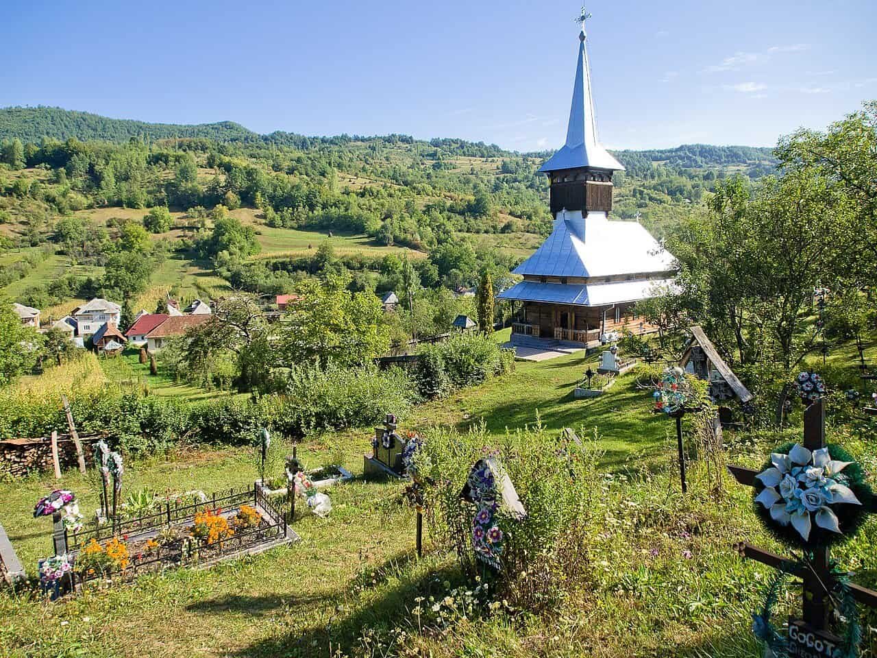
UNESCO Cultural Sites

  • On the puszta, men still ride standing on five horses

    On the puszta, men still ride standing on five horses

    On Hortobágy, Europe’s last great steppe, a way of life persists that exists nowhere else on the continent. The csikós riders in their deep blue shirts, the grey Hungarian cattle with horns wide enough to span five feet, and the racka sheep with their spiralling corkscrew horns — all of it is still here, not as a museum exhibit, but as ordinary work.

    Nature · Hungary

    It is half past seven on an October morning, and I am standing on the Nine-Holed Bridge in Hortobágy. In front of me the puszta stretches out, flat and infinite, until sky meets grass with not a single tree on which to rest the eye. A single rider appears in the distance — first a dark dot, then a silhouette in deep blue shirt and a wide-brimmed hat. He is moving a herd of grey cattle towards a gémeskút, one of the traditional shadoof wells still in use on the plain. It is not a performance. It is his work.


    Europe’s last real steppe

    Hortobágy National Park sits in eastern Hungary, between the Tisza river and the city of Debrecen, and covers 800 square kilometres. It is Hungary’s first national park — established in 1973 — and since 1999 a UNESCO World Heritage site, classified as a “cultural landscape”. It is Europe’s largest semi-natural grassland and the westernmost reach of the 8,000-kilometre Eurasian steppe that runs all the way to eastern China.

    That matters for how you experience the place. When you stand on the puszta, you are in the same kind of landscape that pastoral peoples have moved through for more than four thousand years. UNESCO inscribed the area not because it is untouched nature — it isn’t — but because it is a working cultural landscape, where humans and animals have lived together so long that their way of doing things is part of the land itself.

    It is a rare classification. It says: this is not wilderness, but neither is it agriculture. It is something third, older, and almost gone from Europe. Only here, on certain Spanish dehesa lands and Romanian mountain steppes, does anything similar still exist.


    The men in blue

    Csikós is the Hungarian word for horse-herders — the men who have traditionally watched over the horse herds on the puszta. Their uniform is not a tourist construction: it is working dress that took its form over centuries. The deep blue shirt and loose blue trousers, the black velvet waistcoat, the wide-brimmed hat with a crane feather in the band — all functional, all from the landscape they work in.

    The most famous riding feat is the Puszta Five. A horseman stands upright on the backs of two rear horses while driving three lead horses ahead of him — five horses, one man, no reins, only voice and whip. It was developed in the nineteenth century, but its origin is the so-called betyár tradition: the highwaymen who lay flat with their horses on the plain to evade the gendarmerie. When you lie flat in tall grass on a flat puszta, you are quite literally invisible.

    Today the Puszta Five has become a performance, but the technique is the same. And when you watch it done by a rider who learned it from his father, who learned it from his father, you feel the difference between an act and an inheritance.


    Animals that almost disappeared

    Hortobágy is home to four breeds, each of which came close to extinction in the twentieth century, and each of which is preserved here by deliberate choice.

    The Hungarian Grey Cattle — szürke marha — is an ancient breed with horns spanning up to a metre and a half, and a silver-grey coat that makes them look like ghosts in the morning mist. They were near extinction in the 1960s; today the herd is over 30,000. They gave the world the word for Hungarian goulash — gulyás means cattle herder.

    Racka sheep are Hortobágy’s other emblem: small, white, with striking spiralling horns that twist upwards like corkscrews. The Nonius horse, originally bred for the Austro-Hungarian cavalry, is now primarily a working horse for the csikós. And finally: the Przewalski’s horse, the only truly wild horse species in the world, was reintroduced here in the 1990s. About 25 animals live freely in a fenced area of the park.

    It is these four animals — the cattle, the sheep, the working horse and the wild horse — that make Hortobágy more than a nature reserve. It is a living catalogue of breeds that ordinary agriculture pushed out long ago.


    The Nine-Holed Bridge and the eighteenth century

    In the middle of the park, where the road between Debrecen and Budapest crosses the small Hortobágy river, sits Kilenclyukú híd — the Nine-Holed Bridge. Built in 1827–1833, it is Hungary’s longest stone road bridge of the nineteenth century, with nine arches mirrored in the still water of the river below. It is one of the most photographed motifs in all of Hungary — and a fully functional piece of infrastructure that cattle are still driven across on market days.

    Right beside it stands Hortobágyi Csárda, an inn from 1781 where salt caravans paused on their way from Transylvania to Vienna. Today it is still a working tavern serving Hungarian goulash, slambuc (a shepherd’s dish of potatoes and bacon cooked in a single pot) and pörkölt. It is not a gourmet experience. It is an experience of what the puszta has eaten for two hundred years.


    The quiet of the morning, the birds of autumn

    Hortobágy is one of Europe’s most important areas for migratory birds. More than 340 bird species are recorded here, and every autumn — particularly from September to November — up to 100,000 cranes gather in the park’s shallow lakes on their way south. It is a sound so distinctive that locals still rise in the dark to witness the arrival. Trumpet-like calls from thousands of birds settling on the water at dusk.

    The bird season is one of three real reasons to plan a journey to Hortobágy. The other two are spring’s birthing season, when the grey calves are released onto the plain, and the annual Hídi vásár — the bridge market — in August, when the puszta’s herders bring their animals to town in a tradition unbroken since the Middle Ages.


    Where to stay

    Hortobágy is not a place of large hotels, and that is part of the point. Hortobágyi Pásztormúzeum Vendégház in Hortobágy village itself is a small guesthouse run by a family with csikós ancestry, where you can be shown around by people whose grandfather rode horses on these fields. Epona Lovas Hotel in Máta, next to the main stud farm, is built specifically for horse-minded guests — rooms overlook the paddock, and riding programmes cater to both beginners and experienced riders.

    For those who want a little more comfort and a working city next door, Aquaticum Hotel in Debrecen, forty minutes away, is a good choice. Debrecen is Hungary’s second city, has one of the country’s best university atmospheres, and combines well with day trips into the puszta.


    Avoid

    The short bus excursion from Budapest with fifty other passengers and ninety minutes on the puszta before being driven back. The puszta only works when you give it a full day — preferably two. The light at dawn and dusk is what makes the place extraordinary; midday in July is just a flat landscape in 35-degree heat.

    Skip high summer in general if you can. May–June and September–October are the right seasons. Spring for new animals and flowers, autumn for the migratory birds and the deep golden light.

    And finally: don’t treat the csikós shows at the Máta stud farm as the main event of the trip. They are good, but the real life of the puszta happens outside the performances. Book a private carriage ride or an outing with a local csikós, and you’ll come much closer to what you came for.


    Arrivals from the Nordic capitals

    TravelTalk is a Nordic publication. Here is how Nordic readers reach Hortobágy.

    From Copenhagen: Direct to Budapest with Wizz Air, Ryanair and LOT, around 2 hours. From Budapest it is a two-hour drive to Hortobágy along the motorway towards Debrecen. Train from Budapest Keleti to Hortobágy via Füzesabony takes about three hours.

    From Oslo: Direct to Budapest with Norwegian and Wizz Air, around 2 hours 30 minutes. Norwegian travellers may notice that Hortobágy’s flat landscape is the absolute opposite of Norwegian nature — and precisely for that reason, an experience that lingers.

    From Stockholm: Direct to Budapest with SAS, Wizz Air and Ryanair, around 2 hours 15 minutes. Sweden has a long tradition of horse breeding and equestrian culture, and Hortobágy gives Swedish travellers a rare chance to encounter a European horse tradition fundamentally different from the Nordic one.

    From Helsinki: Direct to Budapest with Wizz Air and Finnair, around 2 hours 30 minutes. For Finnish travellers there is a linguistic curiosity worth noting: Hungarian and Finnish are distant relatives in the Finno-Ugric language family. Many Hungarian words sound oddly familiar to Finnish ears — not enough to understand, but enough to notice.

    Local transport: A rental car is the best solution. The puszta is large, and distances matter. Hertz and Sixt have desks at Debrecen airport (DEB), which has seasonal flights from several European cities.


    Factbox: practical Hortobágy

    Season: May–June for green plains and births. September–November for migratory birds and the golden autumn light. August for the Hídi vásár market at the Nine-Holed Bridge. Avoid July and the first half of August — the heat is too hard, and the light is flat.

    Language: English at the better hotels and tourist facilities. Hungarian is not easy to pick up on the fly, but even a “köszönöm” (thank you) is met with warmth.

    Currency: Hungarian forint (HUF). Check current rates when planning — it has been volatile in recent years.

    Hotels mentioned: Hortobágyi Pásztormúzeum Vendégház (Hortobágy village). Epona Lovas Hotel (Máta). Aquaticum Hotel (Debrecen).

    Máta Stud Farm: Tours daily from spring to autumn. Horse shows at 10am and 2pm. Book at the entrance or online.

    Hortobágy National Park visitor centre: Petőfi tér 9, Hortobágy. The best overview of the entire area, and the place to arrange private tours with csikós guides.


    This article is for: Nature · Culture · Hungary · Central Europe · UNESCO · Horses · Pastoral heritage · Slow travel

  • The Haraz Mountains: Yemen’s Other Country of Coffee and Stone

    The Haraz Mountains: Yemen’s Other Country of Coffee and Stone

    Life at altitude in the Haraz Mountains

    The qat seller in Manakha wraps my coffee beans in yesterday’s newspaper, his hands moving with the economy of someone who has performed this motion ten thousand times. Outside his shop, the Haraz Mountains drop away in terraces so old they predate Islam, stone walls holding soil that has grown coffee since the 15th century. This is Yemen at 2,500 metres, where the air tastes of cardamom and the villages seem to grow from the cliffs rather than sit upon them.

    The Haraz Mountains: Yemen's Other Country of Coffee and Stone
    Photo: Rod Waddington from Kergunyah, Australia / Wikimedia Commons (cc by-sa 2.0)

    Where Arabia Learned to Drink Coffee

    The Haraz Mountains occupy a peculiar position in the geography of global luxury—they are the source of what was once the world’s most coveted commodity, yet they remain largely unknown to the contemporary traveller. West of Sana’a, the massif rises abruptly from the Tihamah coastal plain, creating a microclimate where afternoon mists roll through valleys and winter rains sustain agriculture that would be impossible elsewhere on the Arabian Peninsula.

    The coffee that grows here, specifically the varietals around Al Hutayb and Bani Matar, commands prices that would make a Geisha producer in Panama nod in recognition. But unlike the carefully branded single-origin bags in London roasteries, Haraz coffee mostly travels through traditional channels—to Saudi buyers who understand terroir in ways that predate modern marketing.

    I stayed at the restored merchant house that now operates as Dar al-Hajar Guesthouse, where the rooms occupy what were once storage chambers for coffee awaiting the caravans to Mocha. The owner, whose family has worked these terraces for seven generations, walked me through his processing method one morning before dawn. We moved between drying beds where beans turned slowly in the mountain sun, and he spoke about rainfall patterns with the specificity of someone whose livelihood depends on reading weather the way others read markets.

    The coffee itself—when finally brewed in the traditional jabana pot over almond-wood coals—carried notes I had never encountered: tamarind, dried lime, something almost savoury that the owner attributed to the volcanic soils specific to this elevation.

    What differentiates the Haraz Mountains from other coffee regions is not merely altitude or microclimate but the complete integration of cultivation into a built landscape that has evolved over centuries. The villages themselves function as part of the agricultural system—their stone towers providing storage, their placement creating microclimates, their terraced foundations extending the growing surfaces. This is not farming as we typically conceive it, but rather a form of inhabited ecology where human settlement and cultivation are inseparable. For those seeking live travel inspiration beyond the conventional luxury narrative, the Haraz Mountains present a different proposition entirely: immersion in a working landscape where beauty and utility have never been divorced.

    The Haraz Mountains: Yemen's Other Country of Coffee and Stone
    Photo: Canbel / Wikimedia Commons (cc by-sa 4.0)

    Architecture That Defies Geology

    The stone towers of Haraz villages—particularly in Manakha, Hajjarah, and Thula—represent one of the world’s most distinctive vernacular architectures, yet they receive a fraction of the attention lavished on, say, Tuscan farmhouses or Provençal mas. Built from the same basalt and limestone that forms the mountains, these structures rise five, six, sometimes seven storeys directly from cliff faces, their walls tapering as they climb, their upper floors featuring the distinctive white-framed windows that break the monochrome stone like teeth. The structural logic is Ottoman in its sophistication: thick walls at the base for storage and livestock, middle floors for daily living, upper levels for entertaining and sleeping where the air moves more freely.

    At Sama Tower in Al Hajjarah—now operated as a guesthouse by the Al-Hajj family—I spent three nights in a room whose windows looked directly down a thousand-metre drop into the wadi below. The architecture creates a curious psychological effect: you feel simultaneously exposed and completely secure, suspended between earth and air. The restoration here respects original materials and techniques while introducing minimal modern comforts—running water, proper ventilation, electrical lighting that doesn’t compete with the oil lamps still used in common areas. This is not preservation as museum practice but as living adaptation, and it represents exactly the kind of culturally grounded luxury that justifies the complexity of reaching these mountains.

    What makes the Haraz architectural tradition particularly compelling is its response to specific environmental pressures. These are not decorative choices but survival strategies: the tall, narrow profile presents minimal surface area to wind and sun; the thick walls regulate temperature in a climate of extreme diurnal variation; the upper-floor majlis rooms with their surrounding windows create natural ventilation that makes the hottest afternoons tolerable. Standing in such a room at sunset, watching the light change across the western ranges, you understand that this is luxury defined not by excess but by precision—every element serving multiple purposes, nothing wasted, nothing merely ornamental.

    The Weekly Market at Suq al-Khamis

    Thursday market in the Haraz town of Bait al-Faqih draws traders from across the western highlands, a weekly convergence that has operated on the same site since at least the 16th century. By the time I arrived at eight in the morning, the main square was already dense with commerce: sacks of coffee beans arranged by varietal and elevation, mounds of qat wrapped in banana leaves, daggers with handles of rhino horn and sandalwood, bolts of cloth from India and Somalia, frankincense from the Mahra, honey from the higher elevations where bees work the ziziphus flowers.

    I came to understand the market not as spectacle but as information system—a weekly aggregation of mountain intelligence. Prices here respond to rainfall, to political developments, to harvest quality, to road conditions in the passes. The coffee merchants assess beans with a fluency that would impress any specialty buyer: they distinguish not just between regions but between specific slopes, specific processing methods, specific harvest weeks. One dealer let me taste through samples from five different elevations around Bani Matar, and the progression was as clear as any wine flight—rising complexity with altitude, more acidity in the highest lots, more body in the mid-elevations.

    For travellers accustomed to luxury travel guides that emphasise private access and exclusive experiences, Suq al-Khamis offers something more valuable: authentic immersion in an economic and social system that functions exactly as it has for centuries. There is no performance here, no adaptation for tourist consumption. You are simply present in a place where serious business occurs according to protocols that predate the nation-state. This is the experiential luxury that cannot be engineered—the privilege of witnessing systems that work precisely because they have never been asked to explain themselves to outsiders.

    The essentials: Haraz Mountains

    • Best season: October through March offers the most stable conditions and clearest mountain weather; avoid July-August when rains make roads difficult
    • Getting there: Fly to Sana’a (limited international connections via Cairo, Amman, or Addis Ababa); the Haraz Mountains lie 90-120 kilometres west, requiring 3-4 hours by four-wheel drive with experienced local driver
    • Where to stay: Sama Tower in Al Hajjarah or Dar al-Hajar Guesthouse near Manakha; expect £80-150 per night including meals; advance booking essential through specialist operator
    • Budget signal: £3,000-5,000 per person for week-long itinerary including guide, accommodation, ground transport, and security arrangements; this is not a destination for independent travel
    • Insider tip: Bring cash (USD or Euros) as cards are useless; carry your own supply of bottled water; learn basic Arabic greetings—English is rare outside Sana’a, and cultural respect matters immensely
    The Haraz Mountains: Yemen's Other Country of Coffee and Stone
    Photo: Rod Waddington / Wikimedia Commons (cc by-sa 2.0)

    Terraces That Predate the Prophet

    The agricultural terraces of the Haraz Mountains represent one of the world’s most extensive pre-modern landscape modifications, comparable in scope to the rice terraces of Banaue or the andenes of Peru. UNESCO’s tentative list acknowledges their significance, though full World Heritage designation remains complicated by Yemen’s political situation. Walking these terraces with a local guide—I hired Abdullah, whose family farms near Al Hutayb—you begin to grasp the temporal depth involved. Some of these walls are demonstrably pre-Islamic; others incorporate Roman-era stonework; still others show Ottoman repairs. Yet they all function as a single integrated system, conducting water, preventing erosion, creating the microclimates necessary for coffee, grapes, almonds, pomegranates.

    The maintenance of such terraces requires communal labour and shared knowledge that cannot be transmitted through documentation alone. Abdullah showed me how to read the walls for water stress, how to identify sections needing repair before they fail, how to understand the relationship between upper and lower terraces so that irrigation and drainage work in concert rather than opposition. This is not knowledge that can be acquired quickly or casually—it accumulates across generations, encoded in practice rather than text. That such knowledge persists despite decades of conflict and economic disruption speaks to the resilience of mountain cultures generally and Haraz farming communities specifically.

    For the visitor, walking these terraces at dawn—when the mist is still caught in the valleys and the first light turns the stone walls pink—provides access to a working sublime that differs entirely from the preserved heritage sites more commonly featured in luxury travel narratives. This is not landscape as scenery but landscape as ongoing negotiation between human need and environmental constraint, beautiful precisely because it remains functional and necessary rather than merely picturesque.

    The Question of Going Now

    Yemen’s security situation makes travel here impossible to recommend without significant caveats. The conflict that began in 2015 continues with varying intensity, and while the Haraz Mountains lie in territory that has seen less direct fighting than other regions, the broader infrastructure challenges—limited fuel, uncertain road security, minimal medical facilities—create genuine risks. The British Foreign Office advises against all travel to Yemen, and most insurance policies explicitly exclude coverage there. These are not warnings to be dismissed lightly.

    Yet the Haraz Mountains remain inhabited and functional, and a small number of specialist operators—notably the team at Yemen Journey, based in Sana’a—continue to facilitate travel for those willing to accept the complexities involved. Such travel requires extensive advance coordination, local knowledge, security protocols, and an acceptance that plans may need to change instantly based on conditions. It is emphatically not adventure tourism or war tourism but rather serious travel undertaken with full awareness of context and consequence. The reward is access to one of the world’s most distinctive mountain cultures at a moment when its future—like much of Yemen’s cultural heritage—remains uncertain.

    I make no argument that everyone should or could go. But for those whose travel practice includes engagement with difficult places—who understand luxury not merely as comfort but as rare and meaningful access—the Haraz Mountains present an opportunity that may not persist indefinitely. The coffee terraces will likely survive; they have endured worse than the current conflict.

    But the knowledge systems that maintain them, the architectural traditions that created these stone villages, the weekly markets that aggregate mountain intelligence—these depend on continuity of practice and transmission across generations. They are, in that sense, more fragile than the stones themselves. To witness them now is to accept responsibility for understanding their context completely, and to engage with them in ways that contribute to their persistence rather than their exploitation. That, finally, is the luxury that matters most—the privilege of presence accompanied by the obligation of care.

    Explore further

  • The trulli of Alberobello: a town in two halves

    The trulli of Alberobello: a town in two halves

    The story behind Alberobello’s whitewashed cones

    Alberobello in southern Italy holds more than 1,500 trulli — conical limestone houses built without mortar, a technique inherited from the prehistoric Mediterranean. Most travellers know the town from postcards: streets lined with whitewashed cones, shops, tour groups. That is one half of Alberobello. The other half — Rione Aia Piccola — is still residential, still quiet, and contains the experience the famous half lost to its own success.

    Cultural travel · UNESCO Cultural Sites · Alberobello, Italy

    Eight in the morning in Rione Aia Piccola. A woman hangs laundry between two trulli; a tabby cat watches from a stone step. The whitewashed cones rise behind her in tight rows, their grey limestone roofs catching the early light. Two backpackers from Germany walk past with quiet good mornings and continue on. By ten, the first tour buses will arrive on the other side of the main street, but here the rhythm is older, slower, and undisturbed. People still live in these houses. That is the most important detail.

    Alberobello holds more than 1,500 trulli and joined the UNESCO World Heritage list in 1996 as the most coherent surviving example of an architecture found nowhere else in this concentration. But the town is not a single place. It is two. The main street, Largo Martellotta, divides Rione Monti — the celebrated and crowded tourist quarter — from Rione Aia Piccola — the quieter residential one. Which side you choose first determines which Alberobello you meet.

    The Trulli of Alberobello

    What a trullo actually is

    A trullo is built from local limestone, gathered from surrounding fields, roughly cut, and stacked without mortar — a drystone technique so old it predates written history in this region. The roofs are conical, built up from concentric rings of progressively smaller stones meeting at a peak, often crowned with a whitewashed pinnacle in the shape of a cross, a star, or a zodiac symbol. The pinnacles vary; theories about their meanings vary even more.

    Tour guides will tell you the trullo form was a tax dodge — that 16th-century peasants under Spanish rule built their homes without mortar so they could be quickly disassembled when royal inspectors arrived to register buildings and collect levies. Roof off, no house, no tax; once the inspector left, the roof went back up. How much of this is historical fact and how much has accreted as good storytelling is uncertain. The dry-stone technique itself predates Spanish taxation by millennia, and the form is related to older corbelled structures in Sardinia and the eastern Mediterranean.

    The practical engineering, though, is genuinely impressive. Trulli have double walls for thermal mass against summer heat and winter cold. The conical roofs channel rainwater into internal cisterns — vital in a region without permanent rivers. Hearths and ovens build into the walls. Inside, a single multipurpose room handles sleeping, cooking, storage, and family life. People have lived in these houses for five hundred years. Many still do.


    Rione Monti — the side you know from postcards

    Rione Monti is the larger of Alberobello’s two trullo districts, with around 1,030 structures. It is also the area Alberobello has shaped into a tourist destination since the 1990s. Most trulli here are now shops, restaurants, wine bars, or short-let accommodations. The streets are striking; the foot traffic is constant; in high season it is difficult to walk ten metres without entering somebody else’s photograph.

    This is not necessarily a reason to skip it. Belvedere Santa Lucia, on the higher ground above Rione Monti, gives the best panoramic view of the trulli landscape, particularly at sunset when the limestone takes on warm orange tones. Sant’Antonio Church — built as a trullo, finished in 1927 — is an architectural curiosity worth a stop. Trullo Sovrano, in the northern part of town, is the only two-storey trullo and now serves as a museum where you can see how a wealthier 18th-century family lived inside this architecture.

    But Rione Monti is no longer a residential neighbourhood. It is a display window, polished for visitors. Worth knowing before you arrive.


    Rione Aia Piccola — the quieter half

    Across Largo Martellotta sits Rione Aia Piccola with around 590 trulli. It is smaller, less visited, and remains predominantly residential. Fewer shops here, fewer guided tour groups, fewer Instagram setups. Laundry hangs across narrow alleys. Older women sit on doorsteps in conversation. Children run between the houses on their way home from school. A cat finds the warmest spot of late-afternoon sun.

    This is what UNESCO actually inscribed in 1996 — not an architectural stage set, but a working town where an ancient building tradition still functions as housing. Walking through Rione Aia Piccola early in the morning or late in the afternoon delivers the experience travel writing usually promises and rarely supplies. The quiet is genuine. The scale becomes clear: trulli are small houses, not photographic motifs.

    For anyone wanting to understand what makes Alberobello matter, Aia Piccola is the half to take seriously. The simple rule: go there first, before the buses arrive around 10, or after they have left around 17.


    The Itria Valley is the larger story

    It is easy to forget that Alberobello is one town among many in the Itria Valley, and that trulli exist far beyond its boundaries. The whole valley — between Bari, Brindisi, and Taranto in central Puglia — is dotted with trulli scattered through olive groves and vineyards. Many are not preserved as monuments; they still stand as working farm buildings, doing the same job they did three centuries ago.

    The surrounding towns deserve as much time as Alberobello itself. Locorotondo, ten kilometres north, is a circular hilltop town with whitewashed alleys and an entirely different aesthetic from trulli — it has its own UNESCO-list-of-most-beautiful-villages distinction. Cisternino, a little further north, is known for its bracerie tradition, where you choose meat from a butcher’s counter and have it grilled on the spot for dinner. Martina Franca is the baroque neighbour with palaces and a noted summer opera festival. Ostuni — la città bianca, the white city — sits on a hilltop to the east and can be seen from kilometres away.

    Basing in the valley for three or four days is a better strategy than day-tripping from Bari or Lecce. The trulli experience deepens when you see them in their landscape rather than as a town-sized exhibit.


    Where to stay

    In Alberobello itself: sleeping in a trullo is part of the experience. Trullidea and Tipico Resort offer well-managed individual trulli within the historic centre. For a quieter stay, choose a property in Rione Aia Piccola rather than Rione Monti.

    As a base for the Itria Valley: Borgo Egnazia near Savelletri on the coast is the region’s grand-luxury choice, often ranked among Europe’s leading resorts. Masseria Torre Coccaro and Masseria San Domenico extend the masseria tradition with spa, kitchen, and the kind of inland calm trulli-only stays cannot match. For smaller boutique with character: Don Ferrante in Monopoli on the coast, or Masseria Torre Maizza inland.

    Charming Trulli Houses in Alberobello, Italy
    Charming Trulli Houses in Alberobello, Italy

    Avoid

    The day trip from Bari or Lecce that arrives at 11 and leaves at 16. This is the worst possible visiting window — full crowds, no time for Aia Piccola, no time for the Itria Valley around. If your time is limited, pick a different Puglia destination entirely.

    The 30-to-40-person guided groups moving through the main streets as a unit. The experience becomes neither cultural nor architectural; it becomes logistical. Hire a private guide for two or three hours in the morning, or join a small group (eight people maximum) instead.

    Souvenir shopping in Rione Monti as the main activity. Most of the goods are mass-produced; this is not artisan craft, it is tourist marketing. For real Apulian products — ceramics, olive oil, wine — drive 15 minutes to Locorotondo or Cisternino and buy directly from producers there.

    The peak summer months. July and August in Alberobello mean maximum crowding and temperatures above 35 degrees. May, June, September, and October are clearly better. Winter — particularly around Christmas — has its own quieter charm; the light is beautiful, the queues are gone, and it does occasionally snow, which is worth seeing if you have not seen a Mediterranean village under snow.


    Getting there from the Nordics

    TravelTalk is a Nordic-perspective publication, and our readers in Copenhagen, Oslo, Stockholm and Helsinki travel to Puglia in significant numbers. Alberobello has no airport of its own — Bari and Brindisi are the two nearest, both well-connected from the Nordics.

    From Copenhagen: Direct flights to Bari with Ryanair and Wizz Air (seasonal) or via Rome, Milan or Munich with SAS, ITA Airways, or Lufthansa. Direct flights take 3 hours; connecting flights take 5-7. From Bari Airport, Ferrovie del Sud Est trains reach Alberobello in around 1.5 hours; by car it is 1 hour.

    From Oslo, Stockholm, Helsinki: Connections via Copenhagen, Frankfurt, Munich, or Rome. SAS, Norwegian, Lufthansa, and Finnair cover the routes. 6-9 hours total travel.

    For 2026 specifically: The new regional rail investment in Puglia improves connections to Lecce, Otranto, and Gallipoli, but for Alberobello and the Itria Valley a hire car remains the best option. The towns are close together; train connections are infrequent; the small distances do not justify the inflexibility.

    Practical: Italy is one hour ahead of the Nordics. Currency euro. EU citizens have no visa requirement. Italian is the main language; English is well-established among younger Alberobello residents because of tourism, less so in the surrounding towns.


    Factbox

    UNESCO status: Inscribed on the World Heritage list in 1996. The protected property covers Rione Monti (1,030 trulli), Rione Aia Piccola (590 trulli), Casa d’Amore, Piazza del Mercato, Museo Storico, and Trullo Sovrano. Total area 11 hectares.

    Best season: May, June, September, October. Winter has its own appeal. July-August is too hot and too crowded.

    Best time of day: Early morning (before 10) or late afternoon and evening (after 17). Belvedere Santa Lucia is best at sunset.

    How long: Half a day for the town itself is the minimum. Two to three days if the Itria Valley is to be experienced properly.

    Combine with: Locorotondo, Cisternino, Martina Franca, Ostuni — all within 30 minutes’ drive. Polignano a Mare on the coast, an hour north. Matera (UNESCO, Basilicata) two hours west, if extra time allows.

    Cultural significance: The trulli are not only an architectural ensemble — they represent a continuous dry-stone tradition. UNESCO’s listing specifically includes the fact that the town remains inhabited as part of what qualifies the site for World Heritage status.

    See also: Our complete guide to Italy


    Other media from Leisure Media Group

    • traveltalk.dk – Danish-language travel magazine covering destinations, hotels, airlines, cruises and travel inspiration from around the world
    • winetalk.dk – Danish-language wine magazine with extensive coverage of wine, gastronomy and food culture
    • worldsporttalk.com – international sports site covering top-level football, golf, tennis, Formula 1 and more from around the world

    This article is for: Alberobello · Trulli · Puglia · Italy · UNESCO · Cultural travel · Itria Valley · Locorotondo · Cisternino · Slow travel · Cultural heritage · Adult travel

  • The Atlas Mountains and the Amazigh cultural landscape

    The Atlas Mountains and the Amazigh cultural landscape

    The Atlas Mountains run 740 kilometres across Morocco and hold the homeland of the country’s indigenous people, the Amazigh — known to most travel guides still as the Berber. This is a living culture in a living landscape, and the journey through it deserves more attention than the day-trip from Marrakech that has reduced Aït Benhaddou to a film set.

    Cultural travel · UNESCO Cultural Sites · Atlas Mountains, Morocco

    It is a quarter to seven in the morning in Imlil, a small town in the High Atlas about an hour’s drive south of Marrakech. A villager walks down the path with three donkeys carrying empty packs. He nods, says something in Tamazight, continues on. Behind him Toubkal rises — at 4,167 metres, the highest peak in North Africa — its summit still holding snow in late April. Marrakech is an hour away. It feels like another country.

    The Atlas is not one mountain range but three — High Atlas, Middle Atlas, and Anti-Atlas — covering around fifteen percent of Morocco’s land area and offering the best hiking terrain in Africa north of Kilimanjaro. But the landscape is not the only reason this region matters. The Atlas is Amazigh territory, and travelling through it without engaging with that culture is like travelling through northern Italy without tasting the wine.


    Who the Amazigh are — and why the word matters

    Most travel guides still use the word Berber. It is an exonym — an outsider’s name — derived from the Latin and Greek “barbarus,” meaning stranger. The people themselves call themselves Amazigh (plural: Imazighen), which means “free people.” It is a name they have used for thousands of years, and the reclamation of identity it expresses is not a small thing. When young Moroccans in 2026 insist on Amazigh over Berber, they are doing something analogous to the way Inuit communities in the Arctic moved away from “Eskimo” as an outsider’s term.

    The Imazighen have lived across North Africa for at least five thousand years, well before the Arabs, the Romans, the Phoenicians, and the French arrived. Today they make up between 40 and 50 percent of Morocco’s population. The Tamazight language gained official recognition as a national language in a 2011 constitutional amendment, and since then the Amazigh script — Tifinagh, one of the world’s oldest writing systems still in active use — has appeared on official signage across the country. Arrive in Marrakech airport in 2026 and you see Tifinagh on the signs alongside Arabic and French. This is recent. It is deliberate.

    Morocco’s Amazigh are not a single people but several. The Riffians of the Rif Mountains in the north speak Tarifit. The Zayanes of the Middle Atlas around Khenifra speak Tamazight in the narrower sense. The Cheluh (or Shilha) of the Anti-Atlas and the Souss Valley speak Tashelhit and form the largest single group. The languages are related but not mutually intelligible; a man from the Rif and a woman from the Anti-Atlas often switch to Arabic or French when they meet.


    Aït Benhaddou — the UNESCO anchor and its double life

    Aït Benhaddou is a ksar — a fortified village — built of clay-rich earth on the western bank of the Asif Ounila river at the foot of the High Atlas. It was inscribed on the UNESCO World Heritage list in 1987. The recognition is multi-layered: the architecture itself (one of the best-preserved ksar in southern Morocco), the location along the old caravan route between Sub-Saharan Africa and Marrakech, and the continuity of Amazigh dwelling tradition that the ksar form represents.

    By 2026, however, Aït Benhaddou is equally famous as a film location. Lawrence of Arabia was partly shot here. Gladiator too. Game of Thrones used the ksar as Yunkai. International recognition has brought income to the region, but it has also produced visitors who arrive expecting a film set rather than an architectural and cultural monument. The tour companies in Marrakech sell it as “the Game of Thrones location” first and as UNESCO heritage second.

    This creates an interesting traveller’s problem. The visitor who arrives knowing what the ksar actually is meets a different place than the one who arrives by tour bus after a mountain pass and a YouTube trailer. The older parts of the village remain inhabited by a small number of Amazigh families. You can walk up through the lanes, climb to the granary at the top — the view across the Asif Ounila valley from there is one of Morocco’s finest — and understand how the ksar actually worked: as defensive structure, as caravan station, as home.


    The living cultural landscape

    Aït Benhaddou is the anchor, but the larger story is the Amazigh cultural landscape extending across the entire Atlas system. That landscape is not just mountains and earthen towns — it is a complete cultural ecology that continues to function as it always has. Terraced fields cut into mountain slopes. Communal bread ovens where women bake khobz at dawn. Weekly souks in villages like Asni and Tnine Ourika that follow trading rhythms hundreds of years old. Looms in homes where women weave carpets with patterns that mark which tribe they belong to.

    One particularly fascinating detail: in the High Atlas, a whistled language called Assinsg still exists. Shepherds communicate over distances of several kilometres using whistles that mimic Tamazight syllables. It is a candidate for UNESCO’s intangible heritage list. The number of people who still master it is small and falling fast — one of those examples where a piece of cultural heritage may disappear within a generation if nothing changes.

    A traveller cannot rescue an endangered whistle language, but can do something small and meaningful. Buy directly from artisans rather than through souvenir shops. Pay honest prices for carpets and ceramics. Take a meal in a home rather than at a restaurant serving “Berber food” to tourists. The kind of choices that send money down into the culture rather than into intermediaries.


    The 2023 earthquake — and what it means for travelling here now

    On September 8, 2023, a magnitude 6.8 earthquake struck Morocco. The epicentre lay in the High Atlas, around 70 kilometres south-west of Marrakech. Roughly 3,000 people died, the vast majority in Amazigh mountain villages where clay-built houses collapsed. Several known villages including Moulay Brahim and Tafeghaghte were severely affected.

    By 2026 the rebuilding is well advanced but not complete. Most tourist routes function normally; Imlil and Aït Benhaddou are both open. Many villages have new houses built in a combination of traditional methods and earthquake-resistant construction. This is a good reason to travel here — tourism revenue feeds directly into local recovery, and a visitor to Amazigh villages in 2026 contributes to the genuine return to normality the region is working toward.

    It is not a reason to avoid the area. It is a reason to engage with it.


    Where to stay

    In the mountains: Kasbah Tamadot, owned by Richard Branson’s Virgin Limited Edition group, sits in the Asni valley and is the region’s recognised luxury choice — a former Amazigh palace converted into a 28-room hotel with views to Toubkal. The mid-range includes Kasbah du Toubkal in Imlil (community-owned, with profits supporting local projects) and Riad Atlas Toubkal. For walkers: mountain refuges like Refuge du Toubkal and locally-owned gîtes in villages such as Aroumd and Tacheddirt.

    In Ouarzazate as a base for Aït Benhaddou: Le Berbère Palace is the grand-luxury choice, frequented by film stars and crews during productions. Sultana Royal Golf and Berber Lodge are quieter mid-range alternatives. For authentic ksar lodging: Riad Caravane and Dar Mouna in the Aït Benhaddou area itself.

    In the Middle Atlas: Michlifen Resort & Golf near Ifrane is the region’s grand-resort. For smaller boutique: Dar Anebar in Ifrane.


    Avoid

    The day trip from Marrakech to Aït Benhaddou with arrival at 11 and departure at 16. This is the most-sold and least-rewarding format — four hours of driving each way for two hours at a place that deserves more. If your time does not allow two days in the area, choose a different Morocco experience entirely.

    The 30-plus-person guided groups moving through Amazigh villages as a single block. They are intrusive to village life and produce an experience that is more logistical than cultural. Choose a smaller private experience — six to eight people maximum, ideally with an Amazigh guide who can facilitate genuine encounters rather than translate scripted performances.

    Souvenir shopping in Marrakech’s Jemaa el-Fna area as a way to “support Amazigh artisans.” Most goods sold there as “Berber carpets” or “Berber jewellery” are mass-produced and disconnected from the artisans who make the real things. For real things, buy in the mountains directly from producers — or through established cooperatives such as Anou or Cooperative Tighanimine.

    “Berber Night” as the standard hotel-package product. The genuine experience — joining an actual meal in an Amazigh home, hearing music made for the people present rather than for cameras — does not come through a hotel concierge. It comes through a local guide who knows a family willing to invite.


    Getting there from the Nordics

    TravelTalk is a Nordic-perspective publication. Morocco is a significant outbound destination for our readers in Copenhagen, Oslo, Stockholm and Helsinki, particularly during shoulder seasons. The Atlas has no airport of its own; Marrakech is the natural gateway to the High Atlas, with Casablanca and Fes serving the Middle Atlas.

    From Copenhagen: Direct flights to Marrakech with Norwegian, Ryanair, and seasonally SAS. Four hours flying time. To Casablanca direct with Royal Air Maroc, or via Paris/Madrid. From Marrakech airport, transfer to Imlil takes around ninety minutes; to Aït Benhaddou around four hours over the Tizi n’Tichka pass.

    From Oslo, Stockholm, Helsinki: Connections via Copenhagen, Frankfurt, Madrid, or Paris. Six to nine hours total travel.

    For 2026 specifically: The Tizi n’Tichka pass is open year-round but often snow-covered in winter — driving requires winter experience between December and March. April and May are ideal if you want snow on Toubkal while avoiding the summer heat. Earthquake reconstruction continues, but established tourist routes have normalised.

    Practical: Morocco is one hour behind the Nordics in winter, same time in summer. Currency dirham (closed currency — cannot be exchanged outside Morocco). EU citizens have no visa requirement for stays under 90 days. Official languages are Arabic and Tamazight; French is widely spoken in cities; English is found in tourist areas, less so in mountain villages. Mobile phone coverage is reliable on the main routes; less so in higher mountain terrain.


    Factbox

    UNESCO heritage: Aït Benhaddou (1987). Other Moroccan UNESCO sites with Amazigh connections include the Medinas of Fez, Marrakech and Meknes, Volubilis (Roman ruins in the Middle Atlas), and Essaouira; Telouet kasbah is currently under consideration.

    Best season: April-May and October-November for hiking and cultural travel. Summer (July-August) for high-altitude trekking. Winter (December-March) for snow and lower prices, but requires preparation.

    How long: Three days minimum for a meaningful impression. A week for genuine immersion — Imlil base with day excursions, Aït Benhaddou overnight, possibly a Middle Atlas stop such as Ifrane.

    Toubkal: Highest peak in North Africa, 4,167 metres. Climbable in 2-3 days from Imlil. Not technically difficult in summer, but requires fitness and a local guide.

    Languages: Tamazight (in three main dialect groups: Tarifit, Tamazight, Tashelhit). Tifinagh is the Amazigh script, recognised as official alongside Arabic since 2011.

    Etiquette: Always ask before photographing people. Dress modestly in villages. Buy directly from artisans rather than through intermediaries. Learn a few greetings in Tamazight (azul = hello; tanmirt = thank you).


    This article is for: Morocco · Atlas Mountains · Amazigh · Berber · Aït Benhaddou · Imlil · Toubkal · Ouarzazate · UNESCO · Cultural travel · Tamazight · Tifinagh · Mountain hiking · Adventure travel