Krakow is the city Poland never lost
While Warsaw was levelled, Krakow walked out of the war intact. A Nordic-perspective guide to the Old Town, Wawel, Kazimierz and modern Polish cuisine.


While Warsaw was levelled, Krakow walked out of the war intact. A Nordic-perspective guide to the Old Town, Wawel, Kazimierz and modern Polish cuisine.

Poland’s capital is one of Europe’s most underrated cultural cities. A Nordic-perspective guide to the rebuilt Old Town, Łazienki, the jazz scene and Stalin’s Palace of Culture.
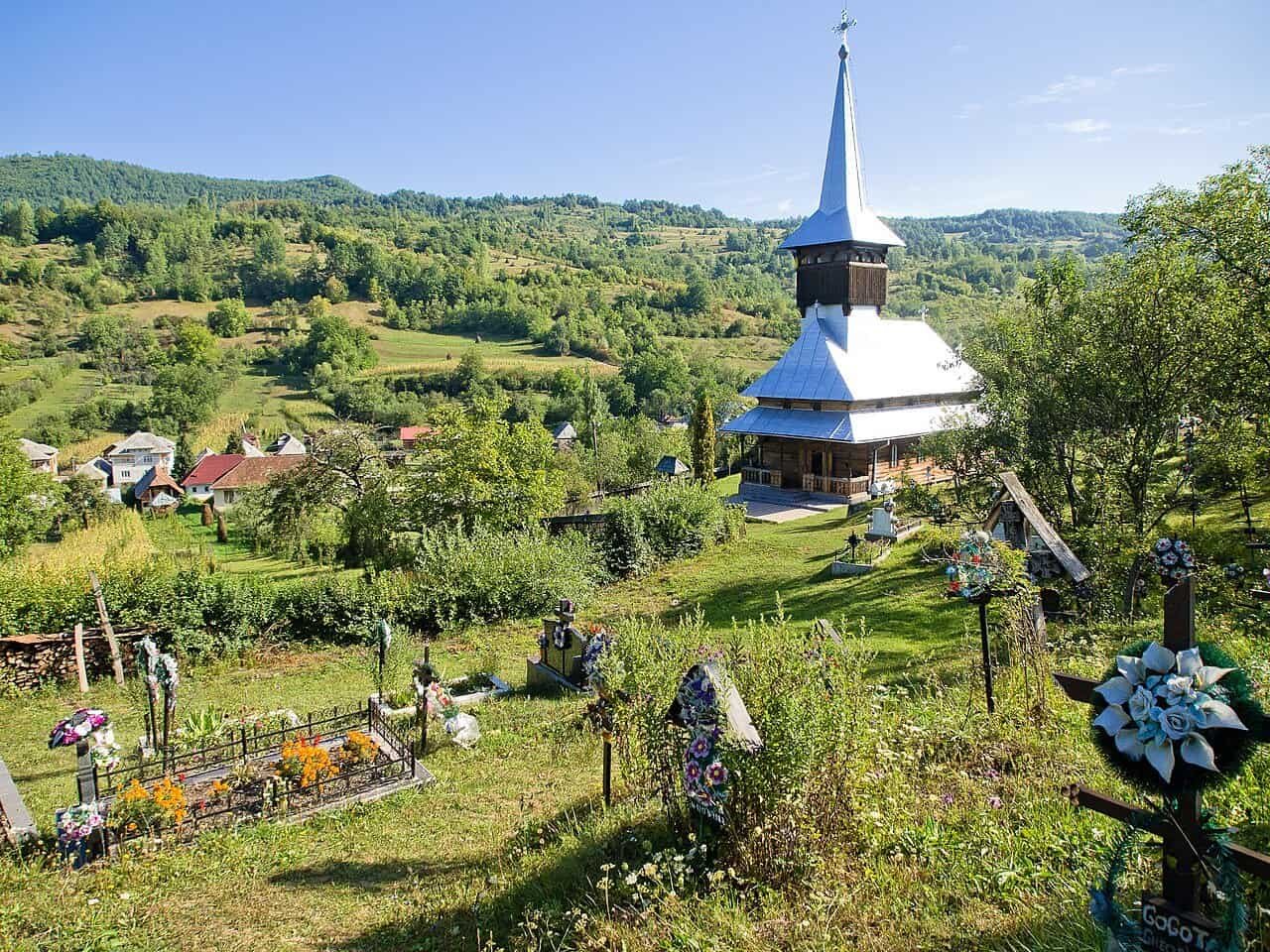
The axe marks are still visible on the oak beams overhead, each strike a century and a half old. Father Vasile stands beneath the nave of Șurdești Church, his hand resting on timber darker than charcoal, and tells me the builders used no…

A private sleeper cabin now costs less than a business-class fare — and unlike the jetway, it gives you the journey itself. This is the quiet revolution in how the discerning traveller crosses a continent: grounded, unhurried, and gloriously analogue. There is a moment you never forget — the cabin lights dim, the dark outside…

Every global metropolis exists in a state of perpetual duality. There is the city engineered for export — predictable, frictionless, polished. And running parallel is the real city, where locals live, debate, and pass down the traditions that define their heritage. The question is how to find your way across. Every global metropolis exists in…

Discover Kenya beyond safari. An editorial travel guide to Nairobi’s culture, the Swahili coast, Lamu Island, and the volcanic landscapes of the Rift Valley. There is a familiar sequence in how international travel writing introduces East Africa. First comes the wildlife: lions moving through dry grass, elephants crossing against orange skies, and the annual migration…

Morocco is more than Marrakech. A Nordic-perspective guide to the four imperial cities, the High Atlas, the Sahara, the Rif mountains and the country’\”s twin coastlines — written for travellers who want the country, not just the postcard.

Hortobágy is Europe’s last great steppe, UNESCO-listed, where the csikós riders still drive their horses in deep blue shirts and racka sheep have spiral horns. A Hungarian world found nowhere else.

Africa is fifty-four sovereign countries, each with its own languages, cuisines, landscapes and travel logic. A Nordic-perspective overview of the continent that’s about to redefine travel for the next decade.

Life at altitude in the Haraz Mountains The qat seller in Manakha wraps my coffee beans in yesterday’s newspaper, his hands moving with the economy of someone who has performed this motion ten thousand times. Outside his shop, the Haraz Mountains drop away in terraces so old they predate Islam, stone walls holding soil that…